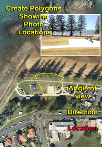
Shows the place the photo was taken, the direction the camera was facing, as well as the angle of view. (zoomed in or wide angle). You can create KMZ (compressed KML) Map files for use with Google Earth, or Geospatial Shape Files, (used with GIS Software). All this can be done using photographs stored in your iPhone or iPad photo album.
You simply select the images you would like to have linked to your map. The selection can be completed by using a map to locate the photos in a specific area, or you may select the images from your existing image library content.
Choose the image storage location that suites you. Images may be stored on Flickr. The Link to these images are recorded and imbedded into the shape file. Choose an alternate option and include the images in your email.
The KMZ and Shape files can be accessed either by emailing them at the time they are created, selecting them from the "Previous Files" tab and emailing, pressing and holding the file entry in the "Previous Files" tab, which presents a menu asking if you would like to open the file in another app, or via iTunes file sharing.
Images can be renamed and annotated by touching and holding your finger pressed on an image in the "Select Photos" page. This opens a page which allows you to specify your own name for the image. You can also either keep the default annotation for the image, or create your own annotation.
The generated Shape Files and KMZ files are compatible with industry standard desktop software, and iPhone or iPad apps which support KMZ Files. The generated Shape File package contains both polygon and point shape files.


